
Pipeline depth of cover represents a primary protective measure against third-party interference and external damage. Changes in terrain, erosion, construction activity, or environmental conditions can reduce cover over time, increasing exposure and risk. Consistent with PHMSA integrity management expectations, monitoring depth of cover supports early identification of exposure, enables risk-based assessment, and informs timely mitigation actions helping operators maintain safe, reliable, and sustainable pipeline operations.
Pipeline depth of cover represents a primary protective measure against third-party interference and external damage. Changes in terrain, erosion, construction activity, or environmental conditions can reduce cover over time, increasing exposure and risk. Consistent with PHMSA integrity management expectations, monitoring depth of cover supports early identification of exposure, enables risk-based assessment, and informs timely mitigation actions helping operators maintain safe, reliable, and sustainable pipeline operations.
Key challenge
Monitoring pipeline depth of cover is essential for safety, compliance, and operational integrity. Challenges include:
Dynamic Landscapes
Detect changes from erosion, weather, and human activities for timely corrective action.
Construction and Excavation
Data Integration
Reporting
Dynamic Landscapes
Detect changes from erosion, weather, and human activities for timely corrective action.
Construction and Excavation
Data Integration
Reporting
Innovative Solution
Skipper NDT’s drone-based aerial magnetometry technology meets oil and gas operators’ needs for precise pipeline depth data. Key features include:
Safety
Inspects pipelines without damage, maintaining integrity while gathering essential data.
Precision
Efficiency
Regulatory Compliance
Cost Reduction
Safety
Inspects pipelines without damage, maintaining integrity while gathering essential data.
Precision
Efficiency
Regulatory Compliance
Cost Reduction
Safety
Inspects pipelines without damage, maintaining integrity while gathering essential data.
Precision
Efficiency
Regulatory Compliance
Cost Reduction
How It Works?
From Field Planning to Actionable Insights.
Each project follows a clear, data-driven process: from feasibility assessment to advanced data interpretation. This method ensures consistent, accurate, and operationally efficient results across all field applications.
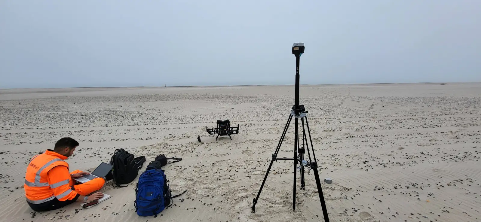
Site Feasibility
01
Assess locations for current conditions: right-of-way status, precise positioning, vegetation coverage, access points, and accessibility to a Cathodic Protection system (CP).
Site Feasibility
01
Assess locations for current conditions: right-of-way status, precise positioning, vegetation coverage, access points, and accessibility to a Cathodic Protection system (CP).
Site Feasibility
01
Assess locations for current conditions: right-of-way status, precise positioning, vegetation coverage, access points, and accessibility to a Cathodic Protection system (CP).
Automatic Drone-Based Inspection
02
Automatic Drone-Based Inspection
02
Automatic Drone-Based Inspection
02
Data Post Processing & Exploration
03
Data Post Processing & Exploration
03
Data Post Processing & Exploration
03
Magnetic Inversion, Optimization Algorithms
04
Magnetic Inversion, Optimization Algorithms
04
Magnetic Inversion, Optimization Algorithms
04
Third Party Data Integration
05
Third Party Data Integration
05
Third Party Data Integration
05
Assessment and Selection
06
Assessment and Selection
06
Assessment and Selection
06
Want to learn more?
Explore technical documentation and recent conference papers related to this field.

The other fields
of application.
Explore other Skipper NDT field applications improving pipeline safety and geospatial intelligence worldwide.


Let’s Discuss Your Integrity Challenges
Whether you are assessing a specific asset, exploring new inspection approaches, or evolving an integrity management program, Skipper NDT’s team is ready to support your objectives.