
Decommissioned Sites and Abandoned Wells
Key challenges
Ensuring the safe retirement of decommissioned wells and pipelines is challenging due to the lack of accurate geospatial information and incomplete historical records.
Field Operator Safety Concerns
Locating wells in remote areas can pose safety hazards for operators due to difficult accessibility.
Expensive
Low Efficiency
Innovative Solution
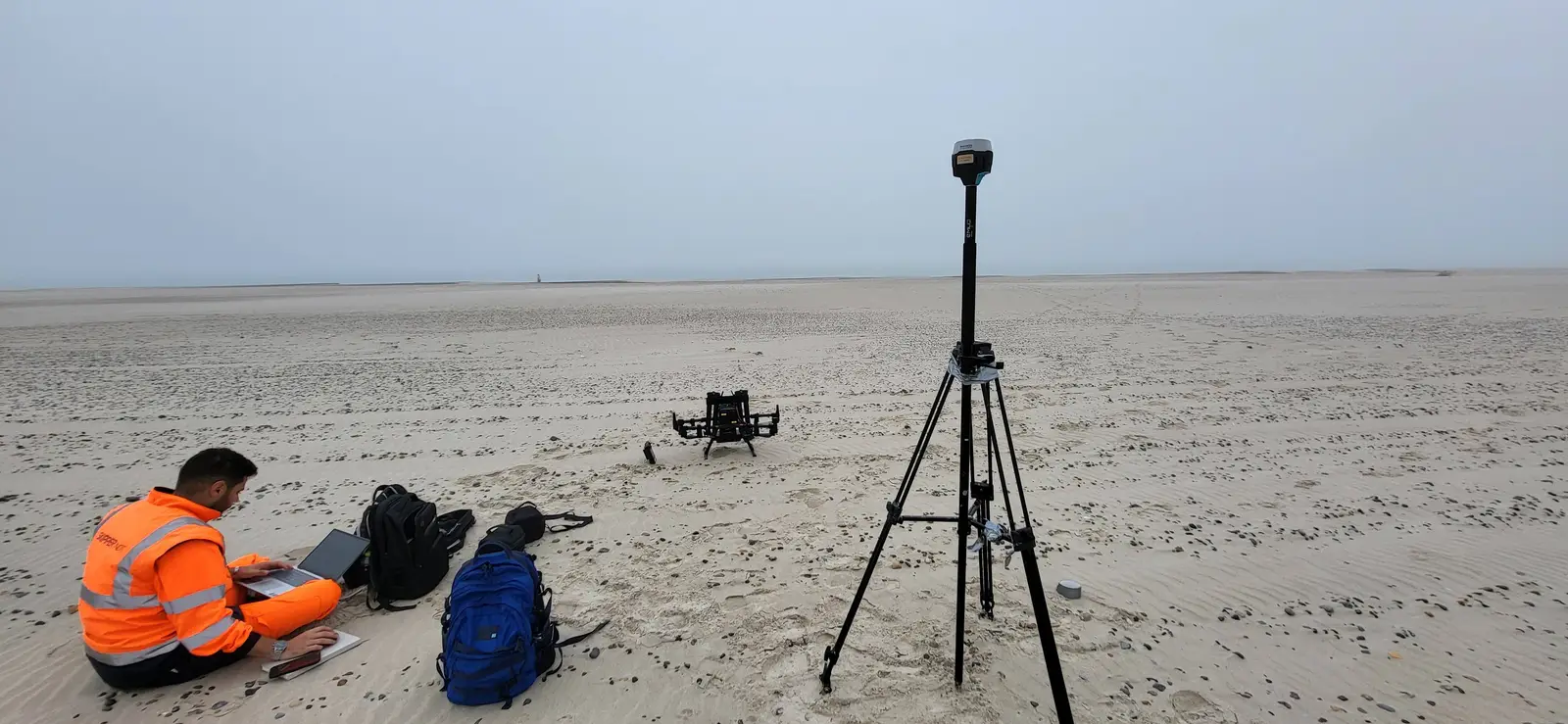
Skipper NDT's Argos sensor combines cutting-edge hardware and software to precisely identify abandoned wells and pipelines using automated magnetic-based technology.
Remote Operation
Enables operations from a distance, enhancing safety and accessibility with minimal personnel required.
Swift Coverage of Large Areas
Real-Time Preliminary Processing
Consistent Data Quality
How It Works?
From Field Planning to Actionable Insights
Each project follows a clear, data-driven process: from feasibility assessment to advanced data interpretation. This method ensures consistent, accurate, and operationally efficient results across all field applications.
Site Feasibility
01
Assess locations for current conditions: right-of-way status, precise positioning, vegetation coverage, access points, and accessibility to a Cathodic Protection system (CP).
Automatic Drone-Based Inspection
02
Data Post Processing & Exploration
03
Magnetic Inversion, Optimization Algorithms
04
Third Party Data Integration
05
Assessment and Selection
06
Want to learn more?
Explore technical documentation and recent conference papers related to this field.

The other fields
of application
Explore other Skipper NDT field applications improving pipeline safety and geospatial intelligence worldwide.


Let’s Discuss Your Integrity Challenges
Whether you are assessing a specific asset, exploring new inspection approaches, or evolving an integrity management program, Skipper NDT’s team is ready to support your objectives.