
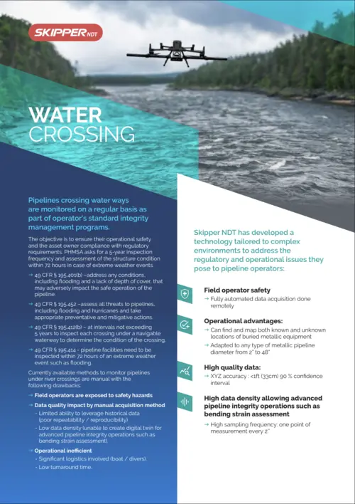
Water crossing
Key challenges
Water crossings are critical points of concern for pipeline operators, presenting a unique set of challenges that demand specialized attention. Ensuring the safety and reliability of pipelines in these areas requires overcoming several technical and operational hurdles.
Depth of Cover
Accurately measuring the soil and sediment above pipelines.
Erosion and Shifting Sediments
Monitoring Systems
Operational Complexity
Innovative Solution
Skipper NDT’s innovative drone-based technology provides precise and accurate positioning of pipelines under water crossings. This efficient, simple-logistics solution helps operators meet regulatory and operational integrity requirements, addressing critical data gaps with several key advantages.
Comprehensive Mapping
Accurate X, Y, Z coordinates and depth of cover (DoC) of the pipeline centerline
Seamless Integration
Advanced Output Formats
Customizable Data Density
Enhanced Environmental Insights
How It Works?
From Field Planning to Actionable Insights
Each project follows a clear, data-driven process: from feasibility assessment to advanced data interpretation. This method ensures consistent, accurate, and operationally efficient results across all field applications.
Site Feasibility
01
Assess location conditions in terms of: right of way suitability, access to the cathodic protection system, and flight authorizations requirements.
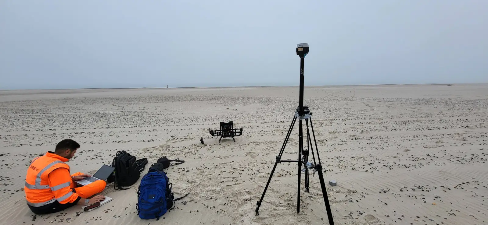
Automatic Drone-Based Inspection
02
Data post Processing & Exploration
03
Magnetic Inversion, Optimization Algorithms
04
Third Party Data Integration
05
Want to learn more?
Explore technical documentation and recent conference papers related to this field.
The other fields
of application
Explore other Skipper NDT field applications improving pipeline safety and geospatial intelligence worldwide.


Let’s Discuss Your Integrity Challenges
Whether you are assessing a specific asset, exploring new inspection approaches, or evolving an integrity management program, Skipper NDT’s team is ready to support your objectives.